![[NB] Creative Futures CIC](http://images.squarespace-cdn.com/content/v1/68c276df7928f778938222f2/98488c41-8030-41a8-b1b4-ee4c899d7119/NBCF+BRAND+MASTER+copy-16.png?format=1500w)
This way to the sea: why we’ve rewritten Finding New Brighton
Step off the train at New Brighton and the first thing the platform hands you is a glass case with nothing in it. It was put there to tell visitors where they are and where to go. Today it’s empty, and taped off.
So people guess. Most of them find the sea in the end, because the streets run downhill and the sky opens up as you go. What they miss is everything in between: the gallery, the shops, the cafés, the stories, the reasons to stay another hour.
That first minute matters more than it looks. In 2024/25, 1.19 million journeys started or ended at New Brighton station. Nine in ten of Wirral’s visitors come for the day, and a day tripper decides where to go on foot, in the moment, with whatever is in front of them. Almost everything worth seeing here sits within ten minutes’ walk of that platform. The OpenAIR Gallery. The independents of the Victoria Quarter. The promenade, Fort Perch Rock and Marine Lake. Nothing tells you so.
We’ve been making this case for more than two years, and today we’ve published a new edition of the report behind it. Finding New Brighton is our wayfinding strategy for the town: one clear system to carry visitors from the station to the sea, and to make sure they meet the town on the way.
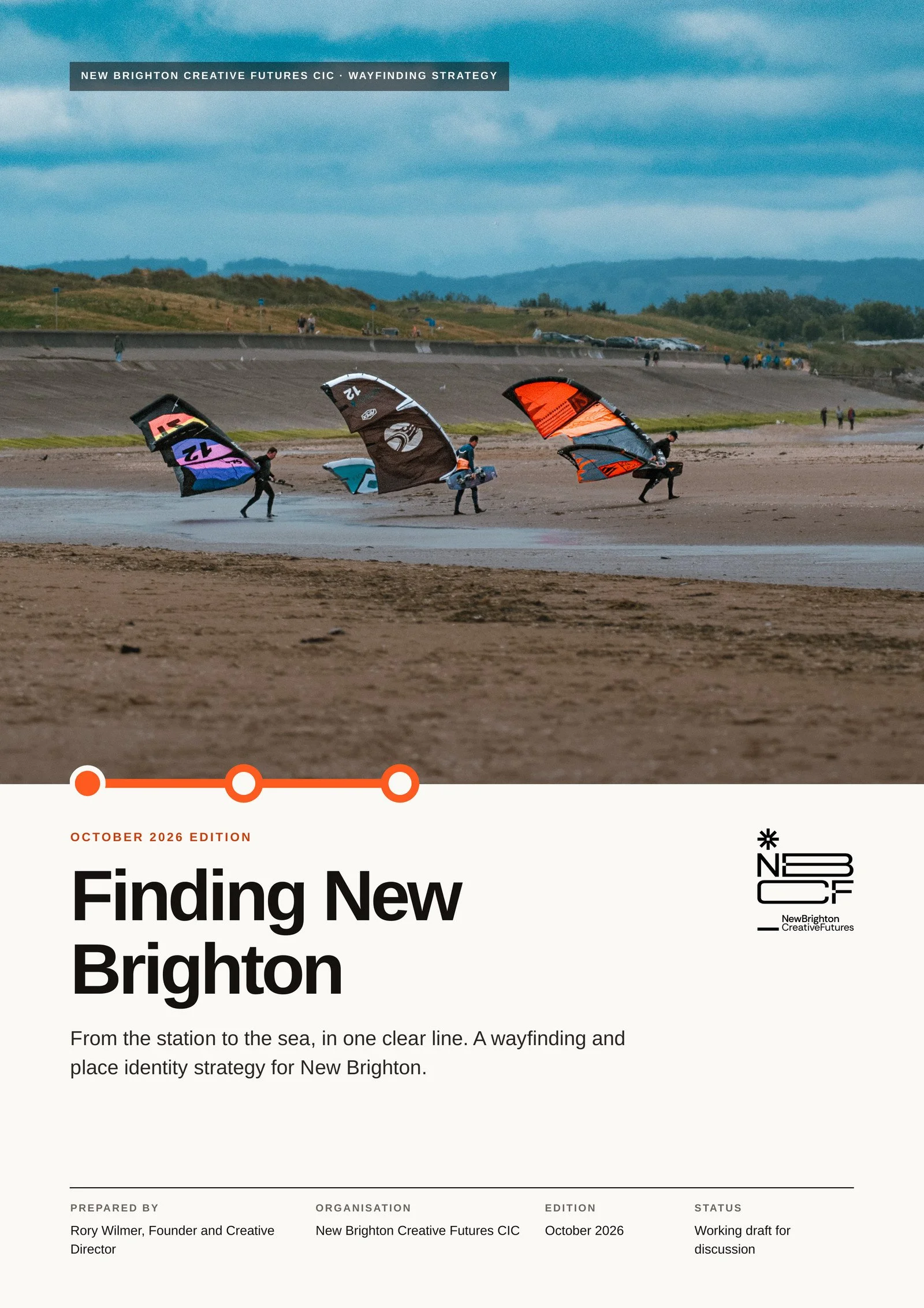
We’ve rebuilt it from the ground up. The first version ran to 42 pages. This one is 17, and you can read it over one coffee. The evidence is new: the latest official station figures, Wirral’s visitor numbers for 2025, and what happened to high streets in London when they were made easier to walk. Every photograph in it is ours, taken on the streets it describes. And for anyone who’d rather watch than read, it comes with a 75-second film.
Before we wrote a word, we walked the route with a camera. A fingerpost weathered almost to a whisper. A beach information board faded by years of sun and salt. Signs and notice boards from different decades, in different styles, some in disrepair, none of them talking to each other. Nobody set out to make it this way. But no single body owns the walk from the train to the tide, so nobody has ever joined it up.
This isn’t about tidiness. It’s about money staying in town. When Transport for London improved streets for walking, those streets saw 93% more people walking than streets left as they were, and 17% fewer empty shops. People who arrive on foot, by bike or by public transport spend 40% more a month in local shops than people who drive. Those were whole-street schemes, not signs alone, but the lesson travels well: make a place easy to walk, and people walk further, stay longer and spend more of their day in it.
So we’re starting small, on the line that matters most. Station first. Then the Victoria Quarter. Then the sea. It’s the natural route: the station sits at the top of the hill and the Victoria Quarter is on the way down, with more than 45 works in the OpenAIR Gallery and the independent shops, cafés and bars around them. That’s where a visit turns into spend. The whole walk takes about eight minutes. Our pilot puts a town map and live train times at the station, fingerposts at the junctions, wall signs on the tighter streets and an orientation panel on the prom. One family of signs, walking times on every one, the town’s stories built in. One short route that tests the whole idea, for a fraction of the cost of a town-wide scheme.
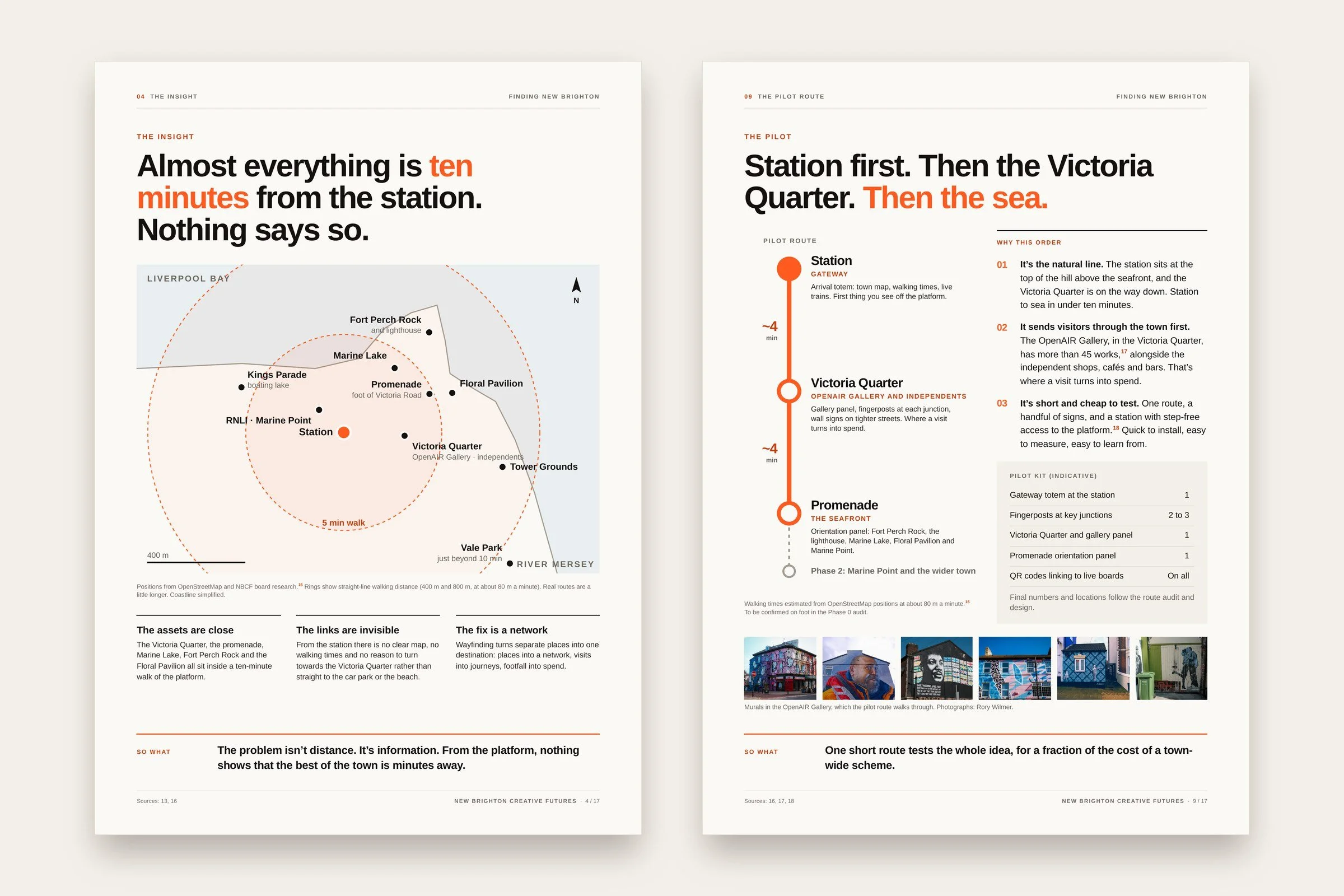
Pages 4 and 9 of the report: the ten-minute map, and the pilot route from the station to the sea.
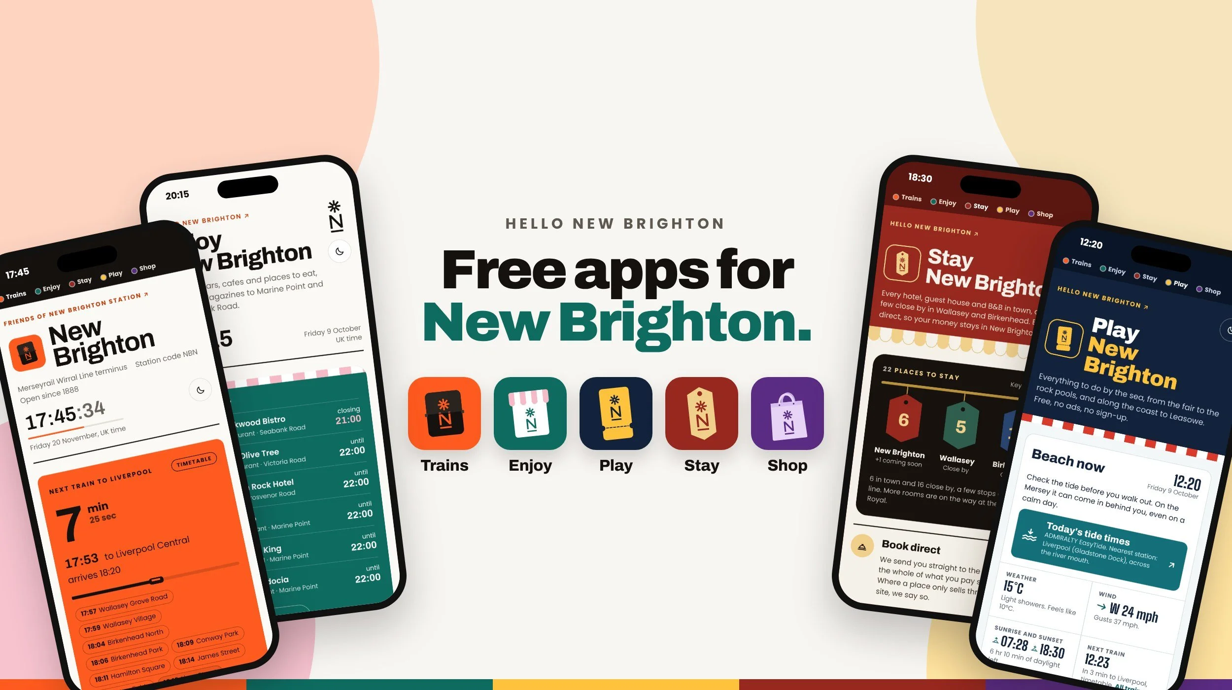
Part of the system is already live. Our five free Hello New Brighton boards, for trains, food and drink, things to do, places to stay and shops, logged 765 visits between 7 and 12 October, more than 500 of them on the train board, from people in town working out what to do next. A sign can point you to the prom. A phone can tell you the next train is in eleven minutes and the tide is on its way out. In our plan the two work together, with a QR code on every sign linking to the live boards, so the posts on the street and the screens in people’s pockets speak the same language.
None of this needs a grand plan or a giant budget. It needs someone to pick it up. Wirral Council already has three transport reports on its work programme: Pedestrian Friendly Wirral in December, the Core Active Travel Network in February and the Combined Authority’s Transport Plan in March. We’re asking for New Brighton station, and the walk from it, to be written into all three. Then an officer lead, a steering group with us, Merseyrail and local partners, and a pilot on the ground before summer 2027.
The report is written for councillors and officers, the Combined Authority, Merseyrail and the businesses along the route. It’s also for anyone who has ever stood outside the station, phone in hand, wondering which way to turn. It’s a working draft, and we’d genuinely like it argued with. If we’ve got something wrong, or missed something you know about this town, tell us. That’s how it gets better.
New Brighton has never been short of things to see. It’s been short of the thread that ties them together. Clear direction creates movement. Movement creates value. Let’s give everyone who steps off that train a reason to turn the corner.
See you down by the water. Soon you won’t need to ask the way.
Tell us what you think → info@hellonewbrighton.com
Small print: Station figures from the Office of Rail and Road, Estimates of station usage, 2024/25. Visitor figures from STEAM 2025, via the Liverpool City Region Destination Partnership. Walking evidence from Transport for London, 2018. Board visits are our own count from Cloudflare Web Analytics, 7 to 12 October 2026, and should be read as a minimum. Walking times are estimates, to be confirmed on foot. Photography by Rory Wilmer. Full sources are listed in the report.
